
Search for cities, countries, lakes and rivers
Vorskla River
© Oleksa Hurtovyi
Vorskla River Current Water Temperature and Forecast
On this page, you will find comprehensive information about the water temperature in Vorskla River, including current readings, historical data and trends, monthly averages, as well as weather forecasts and upcoming temperature predictions. We find every spot where you can swim and tell you what the water temperature is there today and throughout the year.
Current Water Temperature in Vorskla River
55°F
TODAY
56°F
YESTERDAY
53°F
A WEEK AGO
As of today, the minimum water temperature in the Vorskla River ranges from 54°F (12°C) to 60°F (15°C). The water is significantly warmer, and swimming becomes possible for most people. However, caution may still be required for prolonged stays in the water, as extended exposure can cause discomfort. This is a suitable temperature range for short swims and for those accustomed to cooler water. For more comfortable swimming, it is recommended to use proper gear.
It is important to note that these swimming tips and recommendations apply only in good weather. When the air temperature is below 68°F (20°C), and sometimes even below 77°F (25°C), swimming can be unpleasant even with relatively high water temperatures.
Analysis, Historical Data, and Forecast of Water Temperature
Water Temperature Chart for Vorskla River Over the Last 30 Days
Today the water temperature in Vorskla River is lower than the same day in previous years. The water temperature range here in May is from 46°F to 70°F. The water temperature is trending upward, and it has increased both over the past 30 days and the past week.
The forecasted water temperature values for Vorskla are presented in the table below.
The actual water temperature values near the shore may differ by a few degrees from the stated values. For the development of the forecast, we use our own mathematical model that takes into account the current water temperature changes, historical data, and key weather trends, including wind strength and direction, and air temperature in each specific region.
Daily Water Temperature Chart
| Date | Current | Average | Forecast |
|---|---|---|---|
| May 3 | 53°F | 58°F | |
| May 4 | 54°F | 58°F | |
| May 5 | 55°F | 58°F | |
| May 6 | 55°F | 58°F | |
| May 7 | 56°F | 58°F | |
| May 8 | 56°F | 58°F | |
| May 9 | 56°F | 58°F | |
| May 10 | 55°F | 58°F | |
| May 11 | 58°F | 55°F | |
| May 12 | 58°F | 55°F | |
| May 13 | 58°F | 55°F | |
| May 14 | 58°F | 55°F | |
| May 15 | 58°F | 56°F | |
| May 16 | 58°F | 56°F | |
| May 17 | 58°F | 56°F | |
| May 18 | 58°F | 56°F |
Water Temperature Ranges in Vorskla River by Month
January
| Minimum | Average | Maximum |
|---|---|---|
| 36°F | 38°F | 41°F |
February
| Minimum | Average | Maximum |
|---|---|---|
| 36°F | 37°F | 39°F |
March
| Minimum | Average | Maximum |
|---|---|---|
| 36°F | 43°F | 50°F |
April
| Minimum | Average | Maximum |
|---|---|---|
| 37°F | 49°F | 61°F |
May
| Minimum | Average | Maximum |
|---|---|---|
| 46°F | 58°F | 70°F |
June
| Minimum | Average | Maximum |
|---|---|---|
| 55°F | 67°F | 79°F |
July
| Minimum | Average | Maximum |
|---|---|---|
| 64°F | 75°F | 86°F |
August
| Minimum | Average | Maximum |
|---|---|---|
| 64°F | 73°F | 81°F |
September
| Minimum | Average | Maximum |
|---|---|---|
| 50°F | 64°F | 77°F |
October
| Minimum | Average | Maximum |
|---|---|---|
| 41°F | 55°F | 68°F |
November
| Minimum | Average | Maximum |
|---|---|---|
| 36°F | 45°F | 54°F |
December
| Minimum | Average | Maximum |
|---|---|---|
| 34°F | 37°F | 41°F |
Monthly Water Temperature Histogram for Vorskla River
Water Temperature in Cities and Towns on Vorskla River
Vorskla Weather
MAY 10
39°F / 52°F
clear skyhumidity: 83% | wind: 2 mph
MAY 11
45°F / 48°F
moderate rainhumidity: 88% | wind: 2 mph
MAY 12
39°F / 59°F
overcast clouds: 85-100%humidity: 72% | wind: 2 mph
MAY 13
39°F / 55°F
few clouds: 11-25%humidity: 79% | wind: 1 mph
Water Temperature in Vorskla River: General Trends and Swimming Opportunities
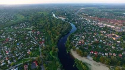
Geographical Location of Vorskla River
Nearby Rivers
Frequently Asked Questions About Vorskla River and its Water Temperatures
What is the current water temperature in Vorskla River?
The water temperature today in Vorskla River is 55°F (12.6°C).
Is it possible to swim in the Vorskla River?
Yes, it is possible to swim in the Vorskla River. However, it's important to ensure safety measures and local regulations are observed.
What major cities are located on Vorskla River?
Cities along the course of Vorskla River include Poltava (Poltava Oblast).