
Search for cities, countries, lakes and rivers
Sea Temperature in Coishco in December
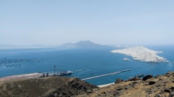
© Ricardo Arroyo
Complete information on the sea temperature range in the Pacific Ocean in Coishco in December. Historical daily data. Climate details for December. Tips on swimming conditions and beach relaxation in Coishco. We find every spot where you can swim and tell you what the water temperature is there today and throughout the year.
Water Temperature Range in Coishco in December
15°C
MINIMUN
18.5°C
AVERAGE
22°C
MAXIMUM
Historical Data of Water Temperature in December in Coishco
Water Temperature Chart for Pacific Ocean in Coishco in December
Sea Temperature Table in Coishco in December Over the Past Years
| Day | 2024 | 2023 | 2022 | Average |
|---|---|---|---|---|
| Dec 1 | 16°C | 17°C | 16°C | 16.3°C |
| Dec 2 | 17°C | 17°C | 16°C | 16.8°C |
| Dec 3 | 17°C | 17°C | 16°C | 16.5°C |
| Dec 4 | 17°C | 17°C | 16°C | 16.8°C |
| Dec 5 | 16°C | 17°C | 16°C | 16.5°C |
| Dec 6 | 16°C | 16°C | 16°C | 16.3°C |
| Dec 7 | 16°C | 17°C | 16°C | 16.5°C |
| Dec 8 | 17°C | 16°C | 17°C | 16.5°C |
| Dec 9 | 16°C | 17°C | 16°C | 16.3°C |
| Dec 10 | 16°C | 17°C | 17°C | 17.3°C |
| Dec 11 | 15°C | 17°C | 17°C | 16.5°C |
| Dec 12 | 15°C | 18°C | 17°C | 16.8°C |
| Dec 13 | 16°C | 17°C | 18°C | 17.0°C |
| Dec 14 | 16°C | 17°C | 18°C | 17.0°C |
| Dec 15 | 16°C | 18°C | 18°C | 17.5°C |
| Dec 16 | 16°C | 18°C | 18°C | 17.5°C |
| Dec 17 | 16°C | 18°C | 18°C | 17.5°C |
| Dec 18 | 16°C | 18°C | 18°C | 17.3°C |
| Dec 19 | 16°C | 18°C | 19°C | 17.5°C |
| Dec 20 | 16°C | 19°C | 18°C | 17.5°C |
| Dec 21 | 16°C | 18°C | 18°C | 17.3°C |
| Dec 22 | 16°C | 19°C | 17°C | 17.3°C |
| Dec 23 | 16°C | 19°C | 17°C | 17.5°C |
| Dec 24 | 16°C | 19°C | 18°C | 17.8°C |
| Dec 25 | 17°C | 19°C | 18°C | 17.8°C |
| Dec 26 | 17°C | 20°C | 18°C | 18.3°C |
| Dec 27 | 17°C | 19°C | 18°C | 18.0°C |
| Dec 28 | 17°C | 19°C | 17°C | 17.8°C |
| Dec 29 | 18°C | 20°C | 17°C | 18.3°C |
| Dec 30 | 18°C | 20°C | 17°C | 18.3°C |


Coishco Climate and Swimming Opportunities in December
23°C
Average Day Air Temperature
16°C
Average Night Air Temperature
1 mm
Precipitation Amount per Month
7 days
Number of Rainy Days
13 hrs
Daylight
per Day
5 hrs
Sunshine
per Day
15 km/h
Average Wind Speed
83%
Average
humidity
Coishco lies within in Peru. The average daytime temperature in Coishco in December is 23°C (74°F), while the nighttime average is 16°C (61°F). There are typically seven rainy days during the month, with a total precipitation of 1 mm (0.0 inches). The daylight duration in December in Coishco is 13 hours, with an average of 5 hours of sunshine per day. The average wind speed in December is 15 km/h (9 mph), and the humidity level is around 83%.
The water temperature in Coishco in December ranges from 16°C to 18°C (61°F to 64°F). At the beginning of the month, the average temperature is around 17°C (63°F), shifting to 17°C (63°F) by mid-December and reaching 18°C (64°F) in the last ten days. Overall, the average sea temperature in Coishco for December is 17°C (63°F). Very comfortable swimming conditions. The water is fresh but not too cold, and the air temperature is pleasant.
Sea Temperature in December in Nearby Cities
Frequently Asked Questions About Water Temperatures in December in Coishco
What is the sea temperature in Coishco in December?
The water temperature in the Pacific Ocean in Coishco in December ranges from 16°C to 18°C (61°F to 64°F).
Is it possible to swim in the Pacific Ocean in Coishco in December?
The average sea temperature in Coishco in December is 17°C (63°F), and the air temperature is 23°C (74°F), so very comfortable swimming conditions. The water is fresh but not too cold, and the air temperature is pleasant.